Northeast '06
June, p.5
| previous page |
home | next page |
Monday, June 18
Moving down the Parkway to the end
today. At the end, we crossed over to the Shenandoah National Park Skyline
Drive to another Park campground for the night. The Skyline Drive is about
105 miles long; the Blue Ridge Parkway was about 470 miles long.
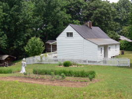
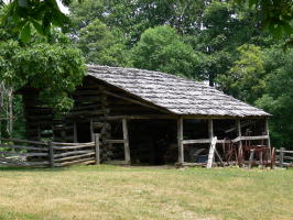 During the day, we stopped for a
hike to the Johnson Farm. It was a working farm until about 1955, and
supplied vegetables and flowers to Mons hotel, a resort hotel in the
Shenandoah's about 1 mile away, advertising cooler temperatures than those found
in the valleys below. We enjoyed looking at these old structures.
During the day, we stopped for a
hike to the Johnson Farm. It was a working farm until about 1955, and
supplied vegetables and flowers to Mons hotel, a resort hotel in the
Shenandoah's about 1 mile away, advertising cooler temperatures than those found
in the valleys below. We enjoyed looking at these old structures.
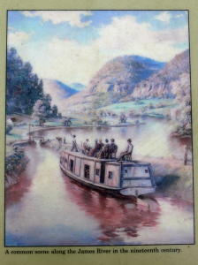
 Two
more pictures today. The first Ed took of a panel on the roadside explaining the
lock system of the James river that allowed boats to be used from tidewater (bay
leading to the ocean) to the Shenandoah's (Roanoke and Lynchburg, specifically). Imagine sitting on a chair on top of a cargo boat!
Two
more pictures today. The first Ed took of a panel on the roadside explaining the
lock system of the James river that allowed boats to be used from tidewater (bay
leading to the ocean) to the Shenandoah's (Roanoke and Lynchburg, specifically). Imagine sitting on a chair on top of a cargo boat!
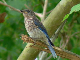
The second is of a bird we can't
identify. Any takers?
Tuesday, June 19.
The Shenandoah overlooks are
different than those of the Blue Ridge Parkway because you are lower in
elevation (2000-3000 feet) and the surrounding countryside is populated.
Lots of old farm communities with interesting homes and barns.
.JPG)
.JPG)
.JPG)
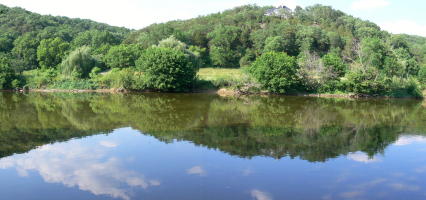
When we came off the mountain, it
was hot: over 90 degrees !. These are pictures of the North Fork of the
Shenandoah river where we stopped for the afternoon and evening at a campground
resort. We had fun walking in the
cool water which was no more than calf or knee height for most of it.
.JPG)
Wednesday, June 20
Today was an interesting day
(aren't they all?) when we drove towards Newark, Delaware to see some friends we
hadn't seen in three years. Instead of taking the Interstates and major
roads, we took towards Frederick, Maryland, then drove the Maryland Scenic Byway
which skirts the top of the state close to Pennsylvania, but consists of about
10 roads. We got lost twice! The fun one was when we entered a road that
said "end county maintenance" then got narrower and narrower before a fairly
sharp drop into an intersection with no route signs. Fortunately, we found
a resident who gave us directions to get back on the road, and we went off just
to get lost again!
Thursday, June 21
Stopped at Harper's Ferry, the
site of John Brown's battle over Black rights during the Civil War. It has
been rebuilt as a National Park. The first picture is of the confluence of
the Shenandoah and Potomac rivers, the reason for its importance.
.jpg)
.JPG)
.JPG)
.JPG)
Here are two buildings, and guess
what? A plaque showing that Meriwether Lewis stopped here for supplies
before his famous expedition. Our travels in the last few weeks have been
at the start and end of Lewis' travels (see Natchez Trace Pkwy earlier this
month).
| previous page |
home | next page |